A unique collaboration between First Nations and various partners restores a stream for salmon.
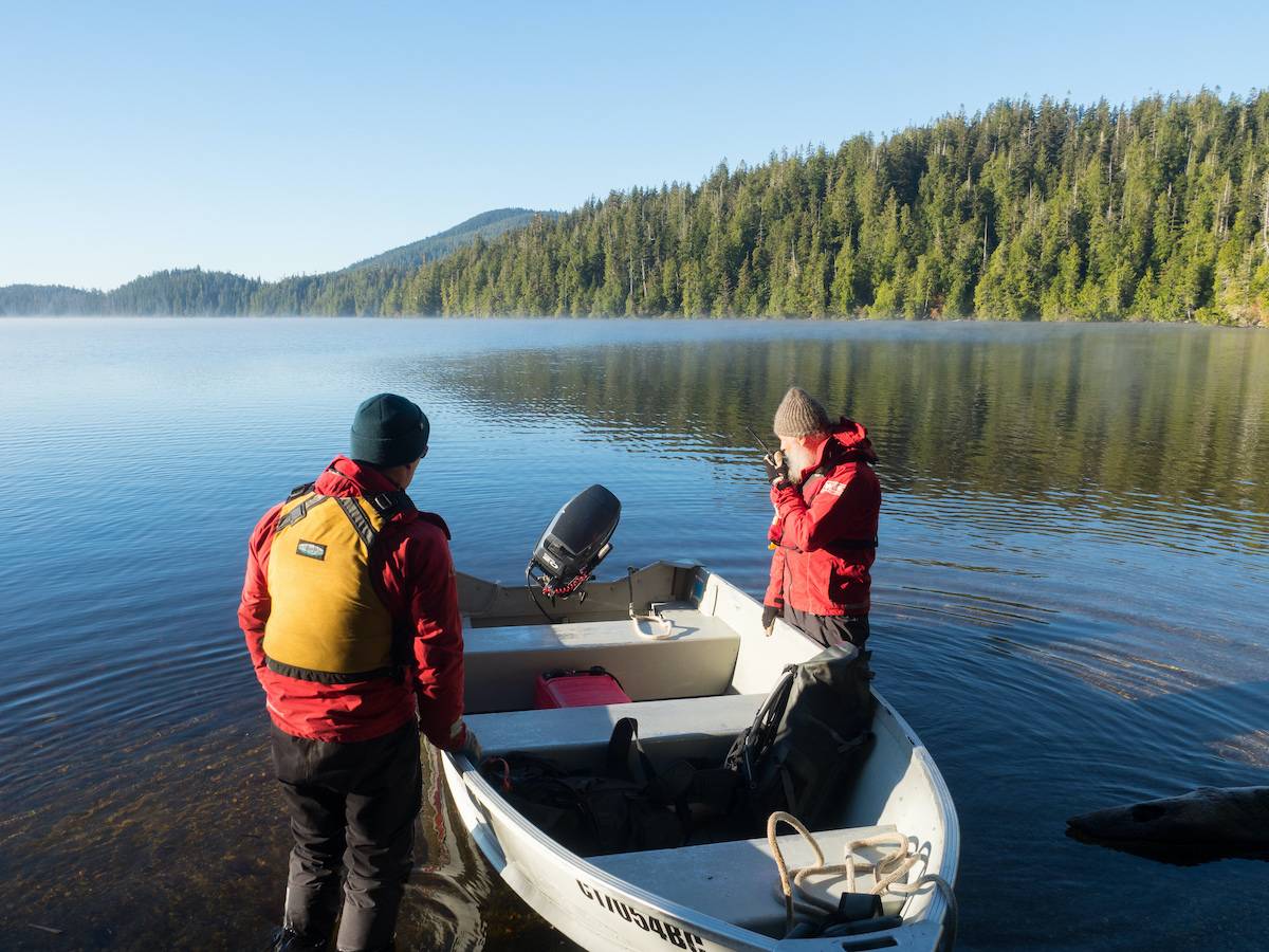
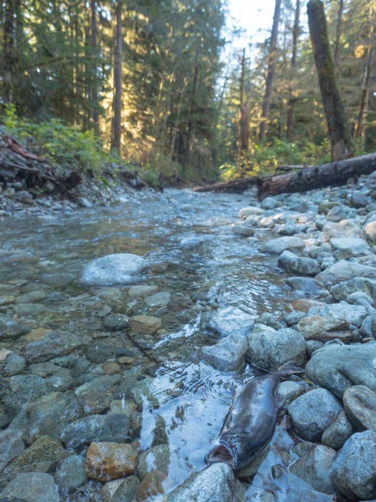
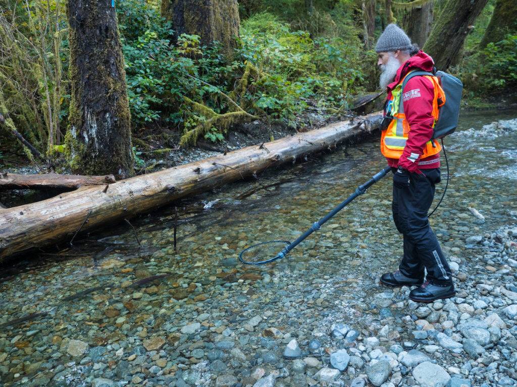
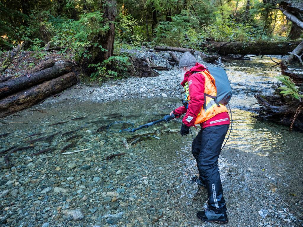
Standing knee-deep in cold, clear water, resource management technician Mike Wald is counting spawning sockeye salmon in a stream officially known as Cheewaht S-2 (Stream 2). One of three streams that feed remote Cheewaht Lake in Vancouver Island’s Pacific Rim National Park Reserve, S-2 is home to an ancient salmon run used by a genetically unique sockeye that since time immemorial has been both vital and sacred to the local Ditidaht people.
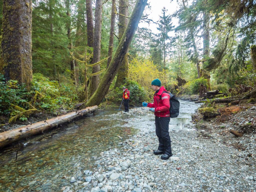
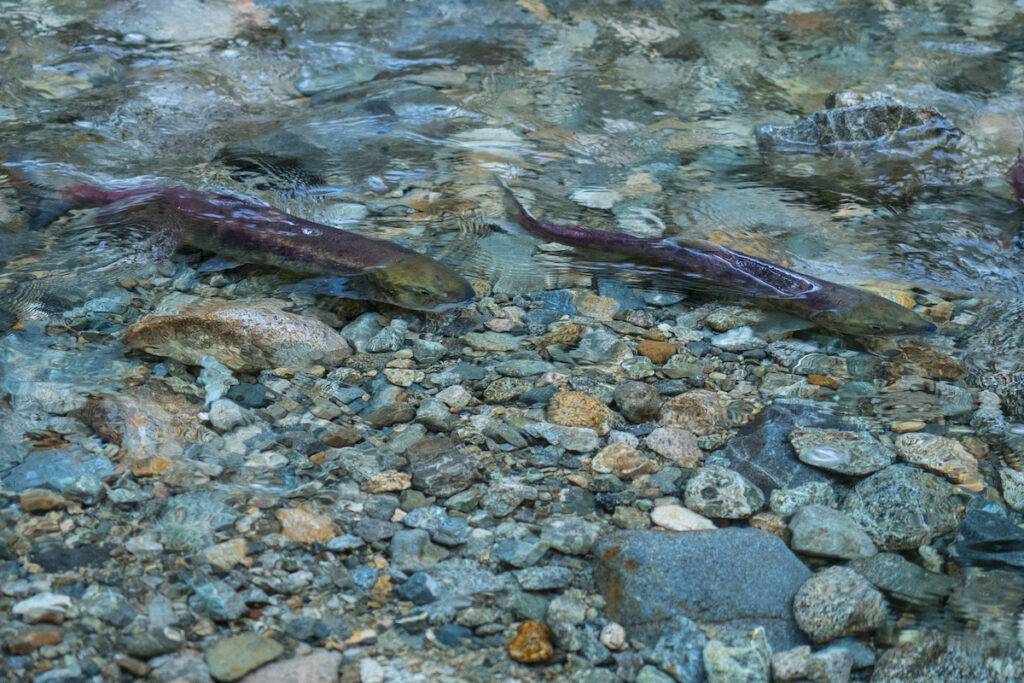
Several steps behind Wald, I stand motionless; any movement could cause the fish to dart away, and counting them as they swim in and out of the shadows is already tricky enough. “Look, a coho.” Wald points to a larger silver fish swimming against the current among the smaller red and green sockeye. “I saw one last week too.”
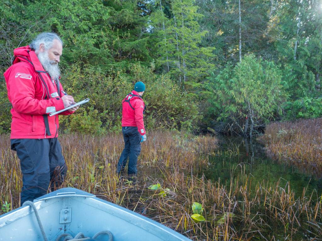
Just behind us, Wald’s co-worker, Yuri Zharikov, an ecologist with the National Park Reserve, is walking along the stream bank, using a scanner to check fish carcasses for tags. “These look like fresh black bear kills,” Zharikov says, pointing to a pile of remains heaped at the base of a towering old growth red cedar.
Soft morning light filters through the Sitka spruce, cedar, and western hemlock forest as I inspect the half-eaten fish. While the look and smell of decay initially overwhelmed my senses, I’ve adapted to the sight and stench of death, and curiosity has taken hold.
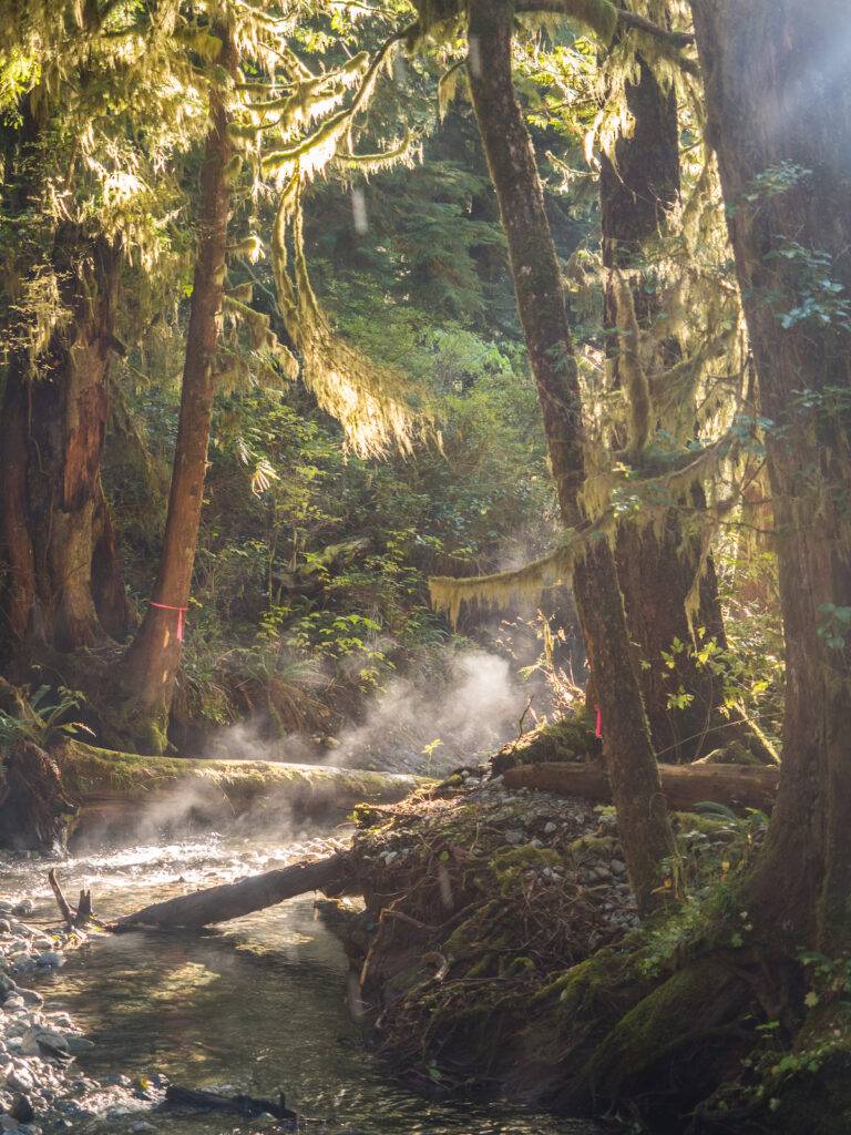
If left to die naturally, these giants will fall, eventually creating backwater nurseries for future young salmon. This elegant, interconnected system is something many Western scientists and political entities are just beginning to grasp. But for Indigenous people, including the Ditidaht First Nation, it’s this kind of Traditional Knowledge that’s always guided the stewardship of their lands and waters.
During spawning season, bears, wolves, eagles, ravens, and other forest species drag the salmon out of the water and scatter their remains across the mossy forest floor. Rich in nitrogen from their years in the ocean, the salmon complete their four-year lifecycle by fertilizing the massive trees. Much later, if left to die naturally, these giants will fall, eventually creating backwater nurseries for future young salmon. This elegant, interconnected system is something many Western scientists and political entities are just beginning to grasp. But for Indigenous people, including the Ditidaht First Nation, it’s this kind of Traditional Knowledge that’s always guided the stewardship of their lands and waters.
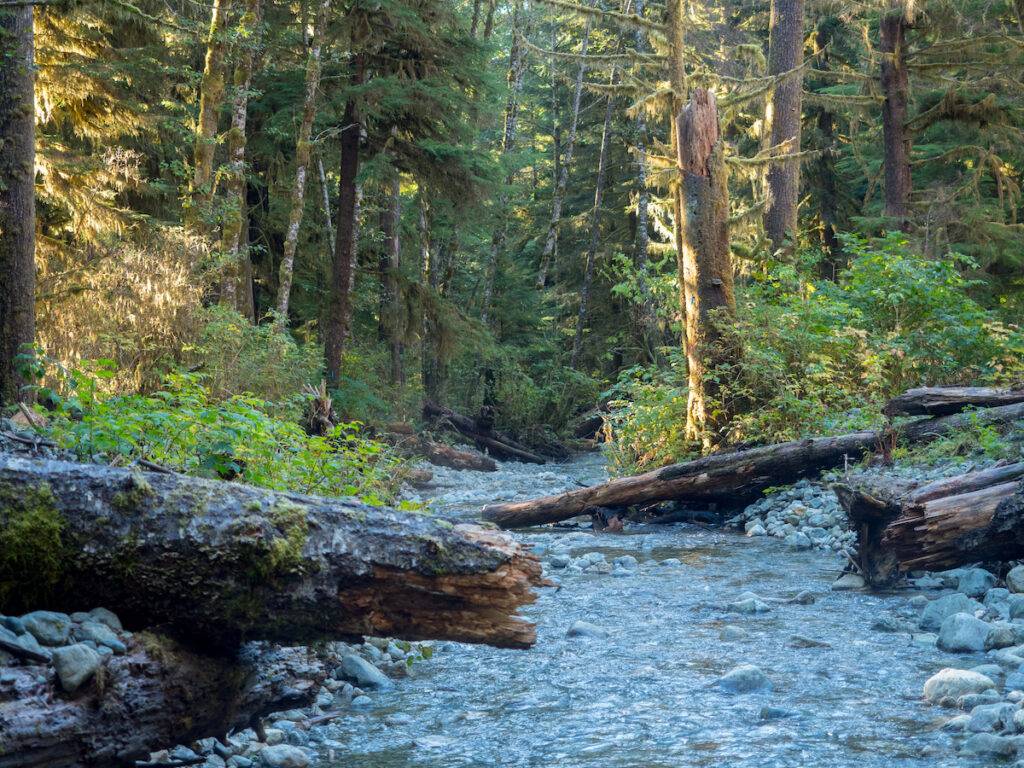
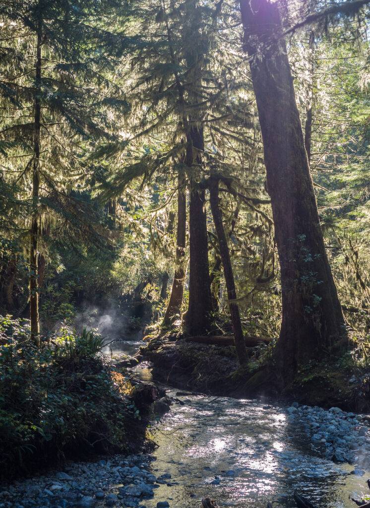
“When I first saw it, it didn’t look like this,” Zharikov says of the gently flowing S-2 as it cuts a meandering path through a seemingly pristine forest. Though this part of the stream and lake fall within the borders of the National Park Reserve, several years ago, industrial logging upstream formed a sediment wedge and log jam. When the jam ruptured, gravel and woody debris washed downstream, destroying an area where coho and sockeye spawned. Over time, sediment from logging continued to fill in the waterway, causing it to overflow its ruined banks. “The salmon were left spawning on the flooded forest floor,” Zharikov says.
The story of Cheewaht Lake and streams 1–3 is, in many ways, a story of the horrors of colonization, and eventually, some reconciliation. The traditional territory of the Ditidaht people extends along the Pacific coast between Bonilla Point and Pachena Point and continues deep into forests that contain some of the largest trees in Canada. Sustaining a large population that spanned several settlements, Paul Sieber, Ditidaht elder and land manager says the village of Clo-oose was the one closest to Cheewaht Lake and its streams.
Pushed onto impoverished reserves — the Ditidaht lost access to their territory and foods. The National Park was formed without their consultation, and a growing web of logging roads began snaking across their traditional landscape.
Set back from a stretch of the famous sandy beach that prompted the development of the National Park in 1970, Clo-oose was located near to where the Cheewaht River flowed into the sea. It was here that Sieber’s ancestors used fishing weirs and traps to harvest the Cheewaht’s unusually small and early returning sockeye salmon. Carefully selecting for the needs of the village, the fishing families released the females to ensure the species’ survival. “They weren’t allowed to overfish,” says Sieber as he describes the ancient laws that govern his people. Clo-oose was also an area of deep cultural significance, with traditional resources providing everything from cedar for canoes to grasses for weaving. Then the federal government took control. “They destroyed the fish weirs. People stopped living in Clo-oose,” says Sieber. Pushed onto impoverished reserves — the Ditidaht lost access to their territory and foods. The National Park was formed without their consultation, and a growing web of logging roads began snaking across their traditional landscape. “We began losing touch with our land,” says Sieber.
According to Parks Canada, as early as 1973, logging practices began to pose a threat to Cheewaht’s pristine ecosystem. The Ditidaht people, who occasionally camped at Clo-oose, began noticing smaller salmon returns and consequently limited their fishery. Seeking information and solutions, they enlisted allies. “When the upper slopes, just outside the park, were logged in 1984, the Ditidaht hired us to assess the damage,” says Mike Wright, owner of a company specializing in environmental assessments and habitat restoration.
It can take several years for logging sediment and debris to move downstream, but by 2008 Wright says it was clear that the watershed was in danger. A Cheewaht watershed restoration roundtable was briefly established that year, but Wright says there wasn’t the political will for it yet.
It can take several years for logging sediment and debris to move downstream, but by 2008 Wright says it was clear that the watershed was in danger. A Cheewaht watershed restoration roundtable was briefly established that year, but Wright says there wasn’t the political will for it yet.
In the years that followed, a few things changed — the condition of the landscape continued to degrade but the political will to address historic wrongs gained momentum. Canada began making active moves toward reconciliation, including working to decolonize the national parks. In British Columbia, the government committed to working with First Nations to develop treaties and land use agreements as promoted by the United Nations Declaration on the Rights of Indigenous Peoples. So in 2017, when the Ditidaht again pushed to protect the salmon, the community listened.
A working group was formed, including representatives of First Nation organizations, several government ministries and agencies, logging companies, and environmental/scientific concerns. Together, they began looking at the issues — objectively, and without any finger pointing. “We said, ‘Look, we all know how we got here,’” says Wright. “… but we all came together to work towards a solution.”
Consulting with the Ditidaht, Parks Canada put together a proposal and dedicated $1.1 million to the restoration of the watershed region (the total cost is estimated at around $2 million). But it was going to take more than money to bring the salmon back: it was going to take Traditional Knowledge, modern science, and an unprecedented level of cooperation. “What we didn’t know is whether everyone would agree to protect the landscape around the headwaters outside the park,” says Zharikov, as he explained that riparian buffers (the natural area around a waterway that’s left intact during logging) are only required in the part of a waterway where the salmon are.
Because there are no fish in the headwaters, that section doesn’t require protection from a legal point of view; but from a practical one, it does. “That was the main purpose of the group, to find a way to ensure the success of the restoration.”
On the strength of a handshake, restoration got underway. In 2020, the team, which consisted of newly trained Ditidaht people, Parks Canada, M.C. Wright (an environmental consulting company), Roc-Star Enterprises Ltd. (a Canadian excavating contractor), and the Nitinaht River Fish Hatchery, began phase one of the project to repair and rebuild the three streams that feed the lake.
The first step was to build a road to the remote lake and then ferry the crews and equipment across the water to the streams. That first season, over 75,000 square feet of habitat were restored. More than 34,000 square feet of gravel were removed, and work was done to re-establish the split between S-1 and S-2 — a task made more complex due to the region’s remoteness and the complexity of getting machinery to the site.
The primary goal was to turn the waterway back into the kind of natural, interconnected ecosystem that can take care of itself.
The following season saw upgrades to the stream split, the removal of logs that blocked the water’s flow, and the restoration of an additional 48,000 square feet of habitat. The primary goal was to turn the waterway back into the kind of natural, interconnected ecosystem that can take care of itself. “Without everyone working together (industry, the park, the Nations, and the Department of Fisheries and Oceans), this never could have happened,” says Sieber. “Even five years earlier, this wouldn’t have happened.”
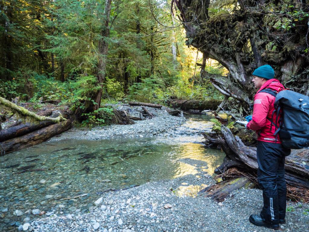
Standing on the banks of S-2, Zharikov and Wald are amazed by the number of returning salmon, which just keep coming. The streams have only been restored for a year; the real test will be in three years, when the salmon spawned this year return. But for now, S-2 has thousands of sockeye salmon laying their eggs in the gravel, beginning, and ending, one of the most wondrous life cycles found in nature.
I point out that a considerable amount of effort and money went into the protection of one tiny salmon run in one remote watershed, and I ask how realistic it is that people in British Columbia will protect more streams. Zharikov turns the question back to me, “What choice do we have?”
For Sieber, the healed creeks show the direction we need to go in the future. It’s a story about new beginnings that goes beyond fish. “For so long, it’s been confrontation,” he says, reflecting on how the national parks, forestry companies, and government groups have long excluded Indigenous voices and knowledge. “This shows the way forward is [through] collaboration and cooperation.”
“We say everything is connected,” he continues. “But until we really understand this, nothing can heal.”
What You Can Do:
- Learn whose traditional land you live on and get to know more about the Nations or communities in your region — what their goals are, what their needs are and what roles they might have for allies.
- Check with your national, state, provincial, or regional parks and learn what restoration work is underway and what help is needed.
- Ask if they’ve consulted the local Indigenous Nations for support and guidance — and if not, encourage that step.